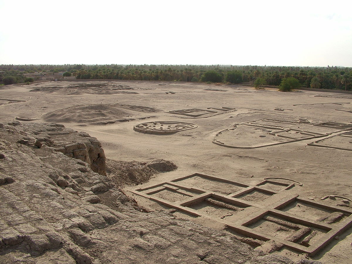
Kerma, also known as Karmah, is archaeological with immense historic importance. It is the former capital of the ancient kingdom of Kerma which is situated in the Dongola Reach (above the 3rd Cataract of the River Nile in Sudan). All these stories are more than 5500 years old. Kerma is one of the largest archaeological sites in the ancient region of Nubia (ancient region in northeastern Africa: extending from the Nile river valley eastward to the shores of the Red Sea, southward to Khartoum or present Sudan and finally westward to the Libyan desert).

Before we get to know more about the present-day Kerma, let’s dig deeper into how the Kerma Culture actually was or what Kerma Kingdom was actually about. As we were talking, this culture flourished from 2500 BCE to 1500 BCE. Although it was mainly based in the Upper Nubia, it later extended into the Lower Nubia as well as the Egyptian border. The primary site which basically forms the heart of the kingdom mainly includes an extensive town as well as a cemetery which consists of large tumuli.
The Kerma Kingdom had quite a few settlement periods. Before we go any further, we should have a look at these periods to get a greater idea about the timeline we will be talking about:
- Pre-Kerma: 3500-2500 BC
- Early Kerma: 2500-2050 BC
- Middle Kerma: 2050-1750 BC
- Classic Kerma: 1750-1580 BC
- Final Kerma: 1580-1500 BC
- Late Kerma (The New Kingdom): 1500-1100 BC
After discovering the site, scientists and researchers have been conducting lots of surveys and studies to learn new facts about it. The Kerma Civilization was identified only from a few townsites and cemeteries from the metropolitan center and other small places. But as the study goes further, we have got to know about many more sites on the channels of the Nile, which lay to the east of the river. This whole pattern indicates a substantial population.

Author Matthias Gehricke.
The domain of Kerma had been as extensive as ancient Egypt. Because it controlled the 1st to 4th cataracts. On top of that, Kerma was way more centralized than Egypt which actually makes sense as the Egyptian records speak highly about its rich and populous agricultural regions. Also, if we go deeper, we will see that they grew wealthy by gold mining and agriculture.
Let’s go a little bit deeper into the history. Kerma was considered to be a threat to Pharaonic Egypt at times. This is the reason we see that there is a long history of Egyptian military activities in the Lower Nubia are which was later added to the Upper Nubia. We also see principal Egyptian fortifications that were built in the middle Nile valley to secure the upper Egyptian border against the raids from the Kingdom of Kerma. It was also to protect the valuable trade routes between the two regions. Actually, Kerma possessed some valuable resources like gold, cattle, dairy products, ebony, ivory, etc. which were really valuable at that time and thus the Egyptians always had an eye on those. Thus the army was built around archers.
The Egyptian control over the region weakened during the 13th dynasty and 2nd intermediate period which is considered to be the period of greatest development of kerma. During its zenith, Kerma shook hands with the Hyksos and tried to crush the Egyptians. Kerma invaded deep into Egypt between 1575-1500 BCE. This was believed to be one of the most humiliating defeats of the Egyptians. This is the reason the Pharaohs later removed this incident from their official historic records. Although, later we see Kerma getting destroyed by various campaigns of various Egyptian rulers. Due to this, the Kerma culture was gradual ‘Egyptianized’, although the rebellions continued it for 220 more years. During the New Kingdom, Kerma eventually became the key ‘province’ of the Egyptian Empire.
Well, by 1700 BC, Kerma was a land of at least 10,000 people. As we learned before, Kerma has a long history of itself and therefore, it has some remarkable artifacts. Kerma’s artifacts are characterized by blue faience. It is a sintered-quartz ceramic material from that age. The sintering process is covered with a vitreous coating as the quartz underwent vitrification which creates a bright lustre of lots of colors, usually more of a transparent blue isotropic glass. The technique was mainly developed by the Kermans back then.
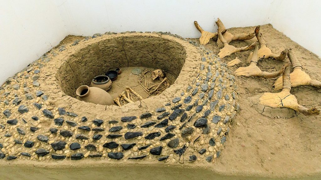
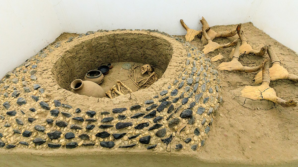
One of the main artifacts of Kerma is its cemetery and the royal tombs. There is a cemetery with over 30,000 graves. There is a general pattern in the cemetery where smaller graves ring the larger ones. This pattern was created to refer to social stratification. This cemetery also includes four extending upwards of 300 feet in diameter at the southern boundary burial mounds. It is believed that these graves have the dead bodies of the final kings of the city as some of the graves carry motifs and artworks that reflect Egyptian deities. To add to that, there are many more artifacts like scarab seals and amulets that are prolific which indicated extensive trade with the Egyptians. After the Kerma Kingdom got sacked, this cemetery was used to host the kings of the Napatan dynasty of the Kingdom of Kush.

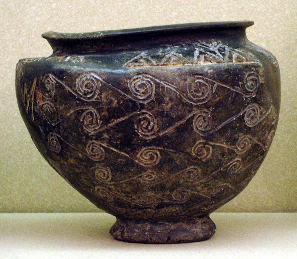
The running-spiral design on this pot is reminiscent of motifs used on pottery and other objects in the Aegean and Eastern Mediterranean during the mid-2nd millennium BC. Its closest parallels, however, are to Egyptian pots of the Second Intermediate Period (1700–1550 BC). Yet the vessel was clearly made in Nubia, using Nile clay and Nubian forming and firing techniques. It suggests greater Nubian knowledge of Egyptian material culture during this period, perhaps derived at least as much from spoils of war as from trade.
An undecipherable inscription incised on the vessel may represent a local potter’s effort to imitate Egyptian hieroglyphic signs, or it may be an attempt to spell a name or word in the language of Kush.” http://isaw.nyu.edu/exhibitions/nubia/highlights.html#
Before we end the brief discussion, let’s have a look at 5 interesting facts from the studies of Professor Charles Bonnet:
- This Kingdom of Kerma, which was also known as the Dukki Gel, is thought to be 1500km along the Nile valley.
- Kerma was an independent, enormous, far-reaching urban center and burial grounds for kings from the Kingdom of Kush.
- The site itself along with its museum had more than 25,000 visitors since 2008, the year it was opened.
- When Kings died, food, jewelry, pottery, furniture, even the humans were sacrificed to the afterlife of the king.
- It is considered that the Kerman Kings were immensely powerful and had strong bonds with the Kurdufan Kings from the South, Darfur Kings from the West, Kasala and Punt Kings from the East so that they stay protected from Egyptian invasions.
